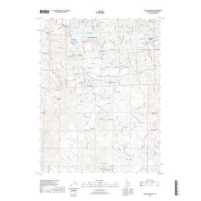
2018 Map of Rough And Ready
USGS Topo · Published 2018About this map
The Sierra Nevada foothills of Nevada County are defined here by the historic community of Rough and Ready and the later development of Penn Valley. This landscape is marked by a complex network of water management features, including the Bald Hill Ditch, Tarr Ditch, and Smith-Gordon Ditch, which reflect the region's long history of hydraulic infrastructure. The residential character around Lake Wildwood contrasts with the surrounding ridgelines and ravines, such as Joe Miller Ravine and Kentucky Ridge. Genealogists will find the Rough and Ready Cem and the local Post Office at the heart of the settlement. Other notable landmarks include the Limberlost Ranch Airport and several distinct peaks like Iron Mtn and Pilot Peak, offering a detailed look at the modern topography of this gold-country locale.
Find a feature on this map
207 named features on this map. Tap any name to fly to it.
Don’t see what you’re looking for? This feature index may not catch every label — zoom into the map to look around manually.
Map Details
Editions of this 2018 Rough And Ready Map
This is the sole edition of this map. No revisions or reprints were ever made.
Other maps of this area

1888 · Smartsville
USGS Topo · 1:125,000

1891 · Smartsville
USGS Topo · 1:125,000

1892 · Smartsville
USGS Topo · 1:125,000

1894 · Smartsville
USGS Topo · 1:125,000

1895 · Smartsville
USGS Topo · 1:125,000

1915 · Spenceville
USGS Topo · 1:31,680

1941 · Bangor
USGS Topo · 1:62,500

1944 · Bangor
USGS Topo · 1:62,500

1948 · Nevada City
USGS Topo · 1:62,500
1948 · Oregon House
USGS Topo · 1:24,000