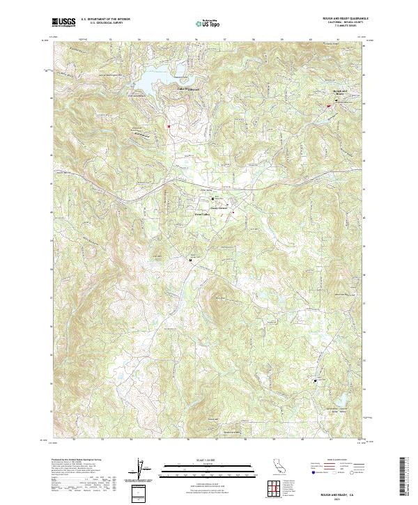
2021 Map of Rough And Ready
USGS Topo · Published 2021About this map
Lake Wildwood dominates the northern landscape of this Nevada County region, where residential development and recreation center around its winding shoreline and Pine Island Beach. To the east, the historic settlement of Rough and Ready maintains its distinct identity near the Rough and Ready Reservoir, while Penn Valley serves as a secondary hub to the south. The area's water management history is etched into the terrain through a network of historic irrigation and mining canals, including the Tarr Ditch, Bald Hill Ditch, and Smith-Gordon Ditch. These features, along with prominent heights like Pilot Peak and Vandevere Mtn, illustrate the transition from early resource extraction to a modern residential and ranching landscape. Genealogists will find several burial sites preserved across the quadrangle, from the Rough and Ready Cem to the Indian Springs Cem located near the Indian Springs Cr.
Find a feature on this map
60 named features on this map. Tap any name to fly to it.
Don’t see what you’re looking for? This feature index may not catch every label — zoom into the map to look around manually.
Map Details
Editions of this 2021 Rough And Ready Map
This is the sole edition of this map. No revisions or reprints were ever made.
Other maps of this area

1888 · Smartsville
USGS Topo · 1:125,000

1891 · Smartsville
USGS Topo · 1:125,000

1892 · Smartsville
USGS Topo · 1:125,000

1894 · Smartsville
USGS Topo · 1:125,000

1895 · Smartsville
USGS Topo · 1:125,000

1915 · Spenceville
USGS Topo · 1:31,680

1941 · Bangor
USGS Topo · 1:62,500

1944 · Bangor
USGS Topo · 1:62,500

1948 · Nevada City
USGS Topo · 1:62,500
1948 · Oregon House
USGS Topo · 1:24,000