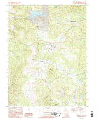
1995 Map of Rough And Ready
USGS Topo · Published 1995About this map
Lake Wildwood sits at the heart of this landscape, its expansive waters and Spillway 1206 defining the local hydrology near Rough and Ready. The map illustrates a rural region in transition, where residential development and recreation at Western Gateway Regional Park meet the enduring imprints of the Gold Country's past. A network of ditches and reservoirs, including the Rough and Ready Reservoir and Rex Reservoir, highlights the sophisticated water management systems required for the area's agricultural and mining history.
Find a feature on this map
27 named features on this map. Tap any name to fly to it.
Don’t see what you’re looking for? This feature index may not catch every label — zoom into the map to look around manually.
Map Details
Editions of this 1995 Rough And Ready Map
This is the sole edition of this map. No revisions or reprints were ever made.
Other maps of this area

1888 · Smartsville
USGS Topo · 1:125,000

1891 · Smartsville
USGS Topo · 1:125,000

1892 · Smartsville
USGS Topo · 1:125,000

1894 · Smartsville
USGS Topo · 1:125,000

1895 · Smartsville
USGS Topo · 1:125,000

1915 · Spenceville
USGS Topo · 1:31,680

1941 · Bangor
USGS Topo · 1:62,500

1944 · Bangor
USGS Topo · 1:62,500

1948 · Nevada City
USGS Topo · 1:62,500
1948 · Oregon House
USGS Topo · 1:24,000