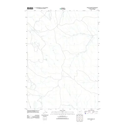
2012 Map of Rough Creek
USGS Topo · Published 2012About this map
Lawyer Rd provides the primary access through this high plains drainage system in Campbell County, where the landscape is defined by an intricate network of intermittent watercourses. In the northern reaches, Rough Creek and Yellow Hammer Creek lead toward the Whitetail Creek basin, while the central territory is dominated by the long, winding path of Dry Creek. The map documents a classic Wyoming ranching environment, where landmarks like Corral Creek and the T-7 Prong suggest the historical and ongoing use of these seasonal draws for livestock management. These drainages, including Jay Creek and Bacon Creek, reveal the natural erosion patterns and land use of the Powder River Basin at the beginning of the 2010s.
Find a feature on this map
11 named features on this map. Tap any name to fly to it.
Don’t see what you’re looking for? This feature index may not catch every label — zoom into the map to look around manually.
Map Details
Editions of this 2012 Rough Creek Map
This is the sole edition of this map. No revisions or reprints were ever made.
Other maps of this area

1954 · Gillette
USGS Topo · 1:250,000

1955 · Newcastle
USGS Topo · 1:250,000

1955 · Gillette
USGS Topo · 1:250,000

1958 · Gillette
USGS Topo · 1:250,000

1958 · Newcastle
USGS Topo · 1:250,000

1962 · Gillette
USGS Topo · 1:250,000

1971 · Open A Ranch
USGS Topo · 1:24,000

1971 · Whitetail Creek
USGS Topo · 1:24,000

1971 · Rough Creek
USGS Topo · 1:24,000
1971 · Whitetail Creek SE
USGS Topo · 1:24,000