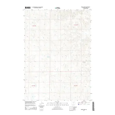
2015 Map of Rough Creek
USGS Topo · Published 2015About this map
Yellow Hammer Cr and Rough Cr carve through this high plains drainage system in Campbell County during the mid-2010s. The landscape is defined by its complex network of ephemeral waterways and draws, including the prominent Williams Draw and the serpentine Bacon Cr. Human imprint on the terrain is sparse, centered primarily on water management and ranch access, as evidenced by the Deaver Number 1 Reservoir and Lawver Rd along the western edge. This survey provides a clear view of the hydrological patterns of the Powder River Basin, where names like Corral Cr and Hay Lakes reflect the area's long-standing cattle-ranching heritage. The map also detail various forks of the local creek systems, such as S Fork Jay Cr and E Fork Coal Cr, which remain critical landmarks for navigation and land management in this open country.
Find a feature on this map
18 named features on this map. Tap any name to fly to it.
Don’t see what you’re looking for? This feature index may not catch every label — zoom into the map to look around manually.
Map Details
Editions of this 2015 Rough Creek Map
This is the sole edition of this map. No revisions or reprints were ever made.
Other maps of this area

1954 · Gillette
USGS Topo · 1:250,000

1955 · Newcastle
USGS Topo · 1:250,000

1955 · Gillette
USGS Topo · 1:250,000

1958 · Gillette
USGS Topo · 1:250,000

1958 · Newcastle
USGS Topo · 1:250,000

1962 · Gillette
USGS Topo · 1:250,000

1971 · Open A Ranch
USGS Topo · 1:24,000

1971 · Whitetail Creek
USGS Topo · 1:24,000

1971 · Rough Creek
USGS Topo · 1:24,000
1971 · Whitetail Creek SE
USGS Topo · 1:24,000