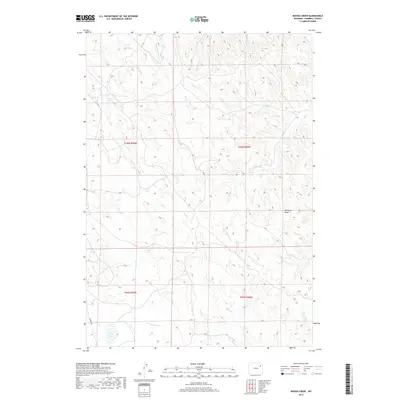
2017 Map of Rough Creek
USGS Topo · Published 2017About this map
Hay Lakes anchor the southwestern corner of this Campbell County landscape, marking a significant hydrologic feature in a territory defined by seasonal drainage and ranching geography. The terrain is intricately carved by an extensive network of ephemeral waterways, including Yellow Hammer Cr, Rough Creek, and the winding Whitetail Cr. These drainages converge and diverge across the high plains, illustrating the complex natural irrigation system that has long dictated land use in the Powder River Basin.
Find a feature on this map
18 named features on this map. Tap any name to fly to it.
Don’t see what you’re looking for? This feature index may not catch every label — zoom into the map to look around manually.
Map Details
Editions of this 2017 Rough Creek Map
This is the sole edition of this map. No revisions or reprints were ever made.
Other maps of this area

1954 · Gillette
USGS Topo · 1:250,000

1955 · Newcastle
USGS Topo · 1:250,000

1955 · Gillette
USGS Topo · 1:250,000

1958 · Gillette
USGS Topo · 1:250,000

1958 · Newcastle
USGS Topo · 1:250,000

1962 · Gillette
USGS Topo · 1:250,000

1971 · Open A Ranch
USGS Topo · 1:24,000

1971 · Whitetail Creek
USGS Topo · 1:24,000

1971 · Rough Creek
USGS Topo · 1:24,000
1971 · Whitetail Creek SE
USGS Topo · 1:24,000