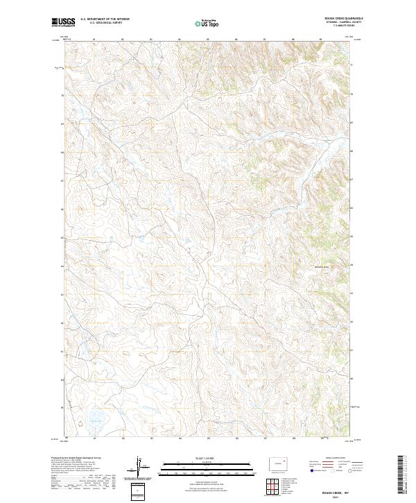
2021 Map of Rough Creek
USGS Topo · Published 2021About this map
Hay Lakes anchor the southern reach of this Campbell County terrain, where a complex network of intermittent drainages defines the high plains landscape. The area is characterized by a series of named draws and creeks, such as Williams Draw and Yellow Hammer Cr, which illustrate the natural drainage patterns that have historically influenced cattle ranching and land use in this part of Wyoming. Remote and largely undeveloped, the map depicts a few rural access points like Lawyer Rd navigating the township boundaries of t46n r70w and t46n r69w. The convergence of waterways like Bacon Cr and Corral Cr suggests the vital importance of surface water management in this high-elevation environment.
Find a feature on this map
18 named features on this map. Tap any name to fly to it.
Don’t see what you’re looking for? This feature index may not catch every label — zoom into the map to look around manually.
Map Details
Editions of this 2021 Rough Creek Map
This is the sole edition of this map. No revisions or reprints were ever made.
Other maps of this area

1954 · Gillette
USGS Topo · 1:250,000

1955 · Newcastle
USGS Topo · 1:250,000

1955 · Gillette
USGS Topo · 1:250,000

1958 · Gillette
USGS Topo · 1:250,000

1958 · Newcastle
USGS Topo · 1:250,000

1962 · Gillette
USGS Topo · 1:250,000

1971 · Open A Ranch
USGS Topo · 1:24,000

1971 · Whitetail Creek
USGS Topo · 1:24,000

1971 · Rough Creek
USGS Topo · 1:24,000
1971 · Whitetail Creek SE
USGS Topo · 1:24,000