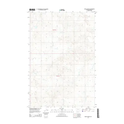
2014 Map of Rough Creek SE
USGS Topo · Published 2014About this map
The complex drainages of Rosebud County define this landscape, where high ridges separate the branching waters of several major seasonal creek systems. The central terrain is dominated by the upper reaches of Wolf Cr and Cottonwood Cr, with its prominent N Fork Cottonwood Cr winding through the northern sections. These watercourses are vital landmarks in a territory divided by the Public Land Survey System, specifically marking the transition between township ranges t10n r41e and t9n r41e. To the west, the namesake Rough Cr and the Redeen feature indicate the rugged hydrology of the northern plains. The eastern and southern reaches of the map show the headwaters for E Fork Horse Cr, W Fork Horse Cr, and Cherry Cr, illustrating the intricate network of coulees and draws that have dictated land use and movement in this part of Montana for generations.
Find a feature on this map
10 named features on this map. Tap any name to fly to it.
Don’t see what you’re looking for? This feature index may not catch every label — zoom into the map to look around manually.
Map Details
Editions of this 2014 Rough Creek SE Map
This is the sole edition of this map. No revisions or reprints were ever made.
Other maps of this area

1954 · Forsyth
USGS Topo · 1:250,000

1957 · Forsyth
USGS Topo · 1:250,000

1958 · Forsyth
USGS Topo · 1:250,000

1968 · Box Canyon Coulee
USGS Topo · 1:24,000

1968 · Schultz Coulee
USGS Topo · 1:24,000

1968 · Black Coulee
USGS Topo · 1:24,000

1969 · Van Burton Creek
USGS Topo · 1:24,000

1969 · Rudie Coulee
USGS Topo · 1:24,000

1969 · Wild Horse Pass
USGS Topo · 1:24,000
1969 · Rough Creek SE
USGS Topo · 1:24,000