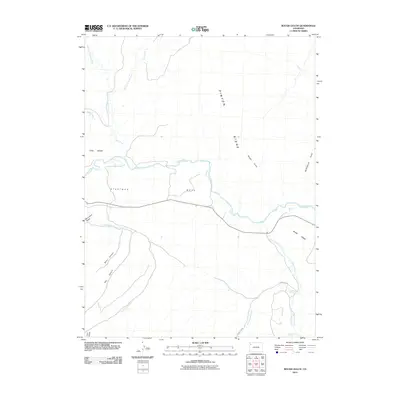
2010 Map of Rough Gulch
USGS Topo · Published 2010About this map
White River drainage patterns and high plateau terrain define this portion of Rio Blanco County as it was documented in 2010. The landscape is characterized by expansive elevated landforms such as Stastman Mesa and Blair Mesa, which are dissected by numerous drainage systems including Yellow Creek and Greasewood Creek. These waterways and their seasonal tributaries have carved a complex network of gulches and canyons, notably Rough Gulch and Monument Gulch, which cut through the prominent Pinyon Ridge.
Find a feature on this map
21 named features on this map. Tap any name to fly to it.
Don’t see what you’re looking for? This feature index may not catch every label — zoom into the map to look around manually.
Map Details
Editions of this 2010 Rough Gulch Map
This is the sole edition of this map. No revisions or reprints were ever made.
Other maps of this area

1907 · Rangely
USGS Topo · 1:125,000

1907 · White River
USGS Topo · 1:125,000

1910 · White River
USGS Topo · 1:125,000

1910 · Rangely
USGS Topo · 1:125,000

1954 · Vernal
USGS Topo · 1:250,000

1958 · Vernal
USGS Topo · 1:250,000

1960 · Vernal
USGS Topo · 1:250,000

1960 · Elk Springs
USGS Topo · 1:62,500
1962 · Calamity Ridge
USGS Topo · 1:24,000
1962 · Divide Creek
USGS Topo · 1:24,000