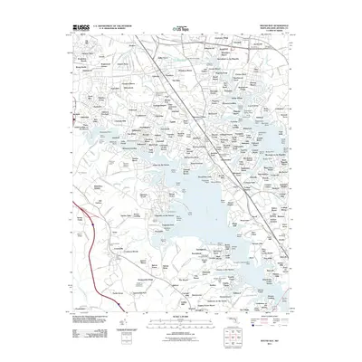
2011 Map of Round Bay
USGS Topo · Published 2011About this map
Magothy River and Severn River define this coastal Maryland landscape, where dense suburban developments and maritime facilities line the many creeks and coves. The peninsula is networked by various residential subdivisions such as Selby Grove, Pasadena, and Severna Park, reflecting the significant post-war growth of Anne Arundel County. Transit and recreation are central to the area's layout, highlighted by the Baltimore and Annapolis Trl following an old rail corridor and the specialized Clements Creek Seaplane Base. Historic and memorial sites are frequent, from the Maryland Veterans Cemetery to smaller burial grounds like Saint Pauls Cemetery. This 2011 survey captures the intricate interface between residential life and the Chesapeake tributaries, including notable landmarks like the Dwight D Eisenhower Golf Course and numerous marinas like the Hamilton Harbour Marina.
Find a feature on this map
340 named features on this map. Tap any name to fly to it.
Don’t see what you’re looking for? This feature index may not catch every label — zoom into the map to look around manually.
Map Details
Editions of this 2011 Round Bay Map
This is the sole edition of this map. No revisions or reprints were ever made.
Other maps of this area

1892 · Owensville
USGS Topo · 1:62,500

1892 · Annapolis
USGS Topo · 1:62,500

1893 · North Point
USGS Topo · 1:62,500

1894 · Relay
USGS Topo · 1:62,500

1895 · Owensville
USGS Topo · 1:62,500

1898 · Choptank
USGS Topo · 1:125,000

1898 · Tolchester
USGS Topo · 1:125,000

1899 · Patuxent
USGS Topo · 1:125,000

1903 · Tolchester
USGS Topo · 1:125,000

1904 · North Point
USGS Topo · 1:62,500