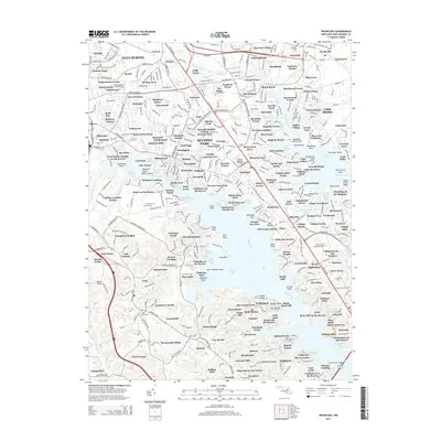
2014 Map of Round Bay
USGS Topo · Published 2014About this map
Severna Park and the deep tidal reaches of the Severn River and Magothy River characterize this suburban Maryland landscape. The survey documents a dense network of waterfront communities and mid-century developments, from the established neighborhoods of Pasadena and Arnold to the shoreline clusters at Arden-on-the-Severn and Round Bay. Settlement patterns are defined by the winding creeks and points, including Whitneys Landing, Cocks Point, and Steedmans Point. Inland, the map captures institutional landmarks like Anne Arundel Community College and the Maryland Veterans Cemetery. The area's heritage is visible in several burial grounds, including the Saint Pauls Cemetery and Arnold Churchyard, while the western edge transitions toward the wooded elevations of Bacon Ridge. This edition provides a detailed look at the infrastructure serving these peninsula communities, such as Ritchie Highway and College Parkway, during a period of sustained growth.
Find a feature on this map
280 named features on this map. Tap any name to fly to it.
Don’t see what you’re looking for? This feature index may not catch every label — zoom into the map to look around manually.
Map Details
Editions of this 2014 Round Bay Map
This is the sole edition of this map. No revisions or reprints were ever made.
Other maps of this area

1892 · Owensville
USGS Topo · 1:62,500

1892 · Annapolis
USGS Topo · 1:62,500

1893 · North Point
USGS Topo · 1:62,500

1894 · Relay
USGS Topo · 1:62,500

1895 · Owensville
USGS Topo · 1:62,500

1898 · Choptank
USGS Topo · 1:125,000

1898 · Tolchester
USGS Topo · 1:125,000

1899 · Patuxent
USGS Topo · 1:125,000

1903 · Tolchester
USGS Topo · 1:125,000

1904 · North Point
USGS Topo · 1:62,500