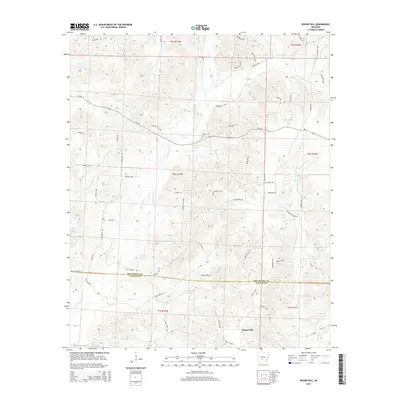
2014 Map of Round Hill
USGS Topo · Published 2014About this map
Round Hill rises as the central topographic landmark in this section of the Arkansas coastal plain, where the border of Hot Spring and Dallas Counties bisects a landscape defined by timber and drainage. The settlement of Sardis-Gem sits in the northern reaches, connected to a web of rural trails and roads such as the Mail Route Rd and S Milk Route Rd. Of particular interest to industrial historians are the timber-related transport lines, including the Green Camp Tram and Clifton Tram, which once supported the region's logging economy. A dense network of waterways, notably L'Eau Frais Creek and Little Cypress Creek, meanders through the township blocks, dictating the placement of early routes like Station Rd and the Pleasant Hill Loop.
Find a feature on this map
67 named features on this map. Tap any name to fly to it.
Don’t see what you’re looking for? This feature index may not catch every label — zoom into the map to look around manually.
Map Details
Editions of this 2014 Round Hill Map
This is the sole edition of this map. No revisions or reprints were ever made.
Other maps of this area

1948 · Malvern
USGS Topo · 1:62,500

1949 · Malvern
USGS Topo · 1:62,500

1955 · Little Rock
USGS Topo · 1:250,000

1956 · Little Rock
USGS Topo · 1:250,000

1960 · Little Rock
USGS Topo · 1:250,000

1964 · Poyen
USGS Topo · 1:24,000

1964 · Little Rock
USGS Topo · 1:250,000

1964 · Donaldson
USGS Topo · 1:24,000

1965 · Round Hill
USGS Topo · 1:24,000
1965 · Willow
USGS Topo · 1:24,000