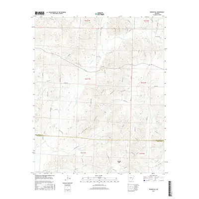
2017 Map of Round Hill
USGS Topo · Published 2017About this map
Round Hill rises as a prominent landmark in this forested corner of the Ouachita Foothills where the boundary between Hot Spring and Dallas counties is defined. The landscape is deeply etched by a dense network of watercourses, including the winding L'Eau Frais Cr and its many tributaries like Easley Cr and Handcock Cr. The small community of Sardis sits in the northern section, served by a spiderweb of rural transit routes including Mail Route Rd and S Milk Route Rd.
Find a feature on this map
65 named features on this map. Tap any name to fly to it.
Don’t see what you’re looking for? This feature index may not catch every label — zoom into the map to look around manually.
Map Details
Editions of this 2017 Round Hill Map
This is the sole edition of this map. No revisions or reprints were ever made.
Other maps of this area

1948 · Malvern
USGS Topo · 1:62,500

1949 · Malvern
USGS Topo · 1:62,500

1955 · Little Rock
USGS Topo · 1:250,000

1956 · Little Rock
USGS Topo · 1:250,000

1960 · Little Rock
USGS Topo · 1:250,000

1964 · Poyen
USGS Topo · 1:24,000

1964 · Little Rock
USGS Topo · 1:250,000

1964 · Donaldson
USGS Topo · 1:24,000

1965 · Round Hill
USGS Topo · 1:24,000
1965 · Willow
USGS Topo · 1:24,000