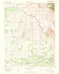
1964 Map of Round Mountain
USGS Topo · Published 1965About this map
Round Mountain rises as a prominent landmark in this landscape of the San Joaquin Valley’s eastern edge, where the Sierra foothills begin to meet the alluvial plain. The map documents an intricate network of water management essential to Fresno County agriculture, dominated by the massive Friant Kern Canal and the meandering paths of the Fresno Canal, Enterprise Canal, and Weldon Canal. These man-made waterways cut through a grid of orchards and vineyards, supported by natural drainages like Dog Creek and Fancher Creek.
Find a feature on this map
59 named features on this map. Tap any name to fly to it.
Don’t see what you’re looking for? This feature index may not catch every label — zoom into the map to look around manually.
Map Details
Editions of this 1964 Round Mountain Map
4 editions found
Other maps of this area

1920 · Orangedale School
USGS Topo · 1:24,000

1922 · Round Mountain
USGS Topo · 1:31,680

1922 · Trimmer
USGS Topo · 1:96,000

1922 · Friant
USGS Topo · 1:31,680

1923 · Malaga
USGS Topo · 1:31,680

1923 · Academy
USGS Topo · 1:31,680

1923 · Orangedale School
USGS Topo · 1:31,680

1923 · Clovis
USGS Topo · 1:31,680

1923 · Wahtoke
USGS Topo · 1:31,680

1923 · Sanger
USGS Topo · 1:31,680