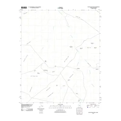
2010 Map of Round Mountain
USGS Topo · Published 2010About this map
The Lazy B Ranch Airstrip and Day Ranch anchor this landscape along the Arizona-New Mexico border, where ranching infrastructure dominates the high desert terrain. The map reveals an intricate network of water management features essential for livestock, including numerous small reservoirs such as Olney Dam, Stateline Dam, and the series of Round Mountain Dam Number Two and Round Mountain Dam Number 3 facilities.
Find a feature on this map
33 named features on this map. Tap any name to fly to it.
Don’t see what you’re looking for? This feature index may not catch every label — zoom into the map to look around manually.
Map Details
Editions of this 2010 Round Mountain Map
This is the sole edition of this map. No revisions or reprints were ever made.
Other maps of this area

1917 · San Simon
USGS Topo · 1:125,000

1926 · Orange Butte
USGS Topo · 1:62,500

1950 · San Simon
USGS Topo · 1:62,500

1951 · San Simon
USGS Topo · 1:62,500

1954 · Silver City
USGS Topo · 1:250,000

1958 · Silver City
USGS Topo · 1:250,000

1959 · Canador Peak
USGS Topo · 1:62,500

1960 · Duncan
USGS Topo · 1:62,500

1962 · Silver City
USGS Topo · 1:250,000
1962 · San Simon
USGS Topo · 1:62,500