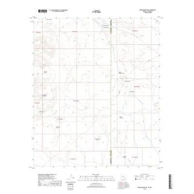
2018 Map of Round Mountain
USGS Topo · Published 2018About this map
The Peloncillo Mountains dominate this high-desert landscape straddling the border between Arizona and New Mexico. This 2018 survey by the U.S. Geological Survey captures a complex network of drainage systems, most notably the winding course of Railroad Wash and the extensive Coyote Wash that carve through the arid terrain. The presence of named landmarks like Round Mtn and the Bobcat Hills provides critical orientation points for hikers and researchers studying this corner of Greenlee and Hidalgo counties. Local water features such as Olney Well Draw and Horseshoe Wash highlight the ephemeral hydrologic patterns typical of the region, while Co RD a028 represents one of the few improved routes providing access through the rugged canyons, including Gillispie Canyon and Grayhorse Canyon.
Find a feature on this map
26 named features on this map. Tap any name to fly to it.
Don’t see what you’re looking for? This feature index may not catch every label — zoom into the map to look around manually.
Map Details
Editions of this 2018 Round Mountain Map
This is the sole edition of this map. No revisions or reprints were ever made.
Other maps of this area

1917 · San Simon
USGS Topo · 1:125,000

1926 · Orange Butte
USGS Topo · 1:62,500

1950 · San Simon
USGS Topo · 1:62,500

1951 · San Simon
USGS Topo · 1:62,500

1954 · Silver City
USGS Topo · 1:250,000

1958 · Silver City
USGS Topo · 1:250,000

1959 · Canador Peak
USGS Topo · 1:62,500

1960 · Duncan
USGS Topo · 1:62,500

1962 · Silver City
USGS Topo · 1:250,000
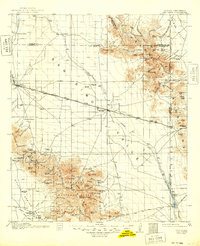
1962 · San Simon
USGS Topo · 1:62,500