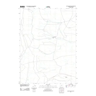
2012 Map of Round Mountain
USGS Topo · Published 2012About this map
The historical Emigrant Trl cuts across this high-desert landscape in Lincoln County, marking a corridor of westward travel that defined the Wyoming territory. This 2012 survey highlights the critical role of water in this arid environment, documenting numerous vital water sources such as Emigrant Spring, Mud Spring, and Jenkins Springs. The terrain is characterized by the complex drainage systems of the Slate Creek forks, including N Fork Slate Cr and Middle Fork Slate Cr, which converge as they flow through the high plains toward the southwest. Dominating the southeastern portion of the map is the prominent landform of Round Mountain, providing a clear landmark for those traversing the cattle trails and draws like Matthews Draw and Horse Trap Draw. This map serves as a detailed record of the intersections between historical migration routes and the natural hydrology of the Green River Basin.
Find a feature on this map
14 named features on this map. Tap any name to fly to it.
Don’t see what you’re looking for? This feature index may not catch every label — zoom into the map to look around manually.
Map Details
Editions of this 2012 Round Mountain Map
This is the sole edition of this map. No revisions or reprints were ever made.
Other maps of this area

1936 · Cokeville
USGS Topo · 1:96,000

1942 · Cokeville
USGS Topo · 1:125,000

1945 · Fort Hill
USGS Topo · 1:62,500

1947 · Fort Hill
USGS Topo · 1:62,500

1954 · Ogden
USGS Topo · 1:250,000

1954 · Kemmerer
USGS Topo · 1:62,500

1955 · Preston
USGS Topo · 1:250,000

1958 · Ogden
USGS Topo · 1:250,000

1958 · Preston
USGS Topo · 1:250,000

1960 · Ogden
USGS Topo · 1:250,000