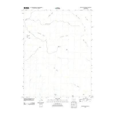
2010 Map of Round Mountain
USGS Topo · Published 2010About this map
Book Cliff Mine and a concentrated cluster of historic workings including the Boyer Mine, Peacock Mine, and Monarch Mine define the industrial footprint of this Colorado landscape. The terrain is deeply incised by a network of drainages such as Cottonwood Canyon, Coal Canyon, and Lewis Wash, revealing the geological layering that supported the local mining economy. Above the canyons, landforms like Round Mountain and the distinct Monument Rocks provide prominent landmarks. In the southern reaches, Mount Garfield overlooks the Moulton Valley, while more isolated markers of human activity, such as Snipes Corral, are found along the higher elevations near Pine Ridge. The map details the transition from high parklands like Indian Park to the complex canyon systems of the desert floor.
Find a feature on this map
26 named features on this map. Tap any name to fly to it.
Don’t see what you’re looking for? This feature index may not catch every label — zoom into the map to look around manually.
Map Details
Editions of this 2010 Round Mountain Map
This is the sole edition of this map. No revisions or reprints were ever made.
Other maps of this area

1929 · Roan Creek
USGS Topo · 1:62,500

1955 · Cameo
USGS Topo · 1:24,000

1956 · Grand Junction
USGS Topo · 1:250,000

1959 · Grand Junction
USGS Topo · 1:250,000

1960 · Grand Junction
USGS Topo · 1:250,000

1962 · Grand Junction
USGS Topo · 1:250,000

1962 · Clifton
USGS Topo · 1:24,000

1962 · Grand Junction
USGS Topo · 1:24,000
1962 · Round Mountain
USGS Topo · 1:24,000

1962 · Corcoran Point
USGS Topo · 1:24,000