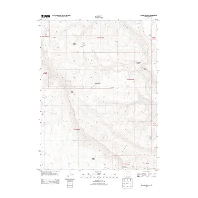
2013 Map of Round Mountain
USGS Topo · Published 2013About this map
Monument Rocks and the distinctive formation of Round Mountain define the high-elevation landscape of Mesa County in this 2013 survey. The terrain is deeply incised by a series of drainages, including Coal Canyon, Cottonwood Canyon, and Main Canyon, which carve through the high plateaus of the region. Notable landmarks such as Snipes Corral suggest the historical and ongoing ranching activity that characterizes this part of the Colorado interior.
Find a feature on this map
28 named features on this map. Tap any name to fly to it.
Don’t see what you’re looking for? This feature index may not catch every label — zoom into the map to look around manually.
Map Details
Editions of this 2013 Round Mountain Map
This is the sole edition of this map. No revisions or reprints were ever made.
Other maps of this area

1929 · Roan Creek
USGS Topo · 1:62,500

1955 · Cameo
USGS Topo · 1:24,000

1956 · Grand Junction
USGS Topo · 1:250,000

1959 · Grand Junction
USGS Topo · 1:250,000

1960 · Grand Junction
USGS Topo · 1:250,000

1962 · Grand Junction
USGS Topo · 1:250,000

1962 · Clifton
USGS Topo · 1:24,000

1962 · Grand Junction
USGS Topo · 1:24,000
1962 · Round Mountain
USGS Topo · 1:24,000

1962 · Corcoran Point
USGS Topo · 1:24,000