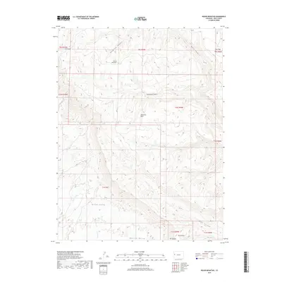
2019 Map of Round Mountain
USGS Topo · Published 2019About this map
Mt Garfield dominates the southeastern corner of this Mesa County landscape, marking the dramatic edge of the Grand Valley as it transitions into the elevated terrain of the Book Cliffs. The map captures a complex drainage system where Indian Wash, Leach Cr, and Lewis Wash carve through the arid geography towards the valley floor. High-elevation landmarks like Round Mountain and Monument Rocks stand as significant topographical features amidst a network of deep incisions, including Cottonwood Canyon and Main Canyon. This 2019 survey illustrates the intersection of natural barriers and early land divisions, showing the Moulton Valley at the southern margin and the high grazing grounds of Indian Park to the northwest. The presence of 27 6 1/4 RD suggests the reach of the county road network into these more challenging environments.
Find a feature on this map
26 named features on this map. Tap any name to fly to it.
Don’t see what you’re looking for? This feature index may not catch every label — zoom into the map to look around manually.
Map Details
Editions of this 2019 Round Mountain Map
This is the sole edition of this map. No revisions or reprints were ever made.
Other maps of this area

1929 · Roan Creek
USGS Topo · 1:62,500

1955 · Cameo
USGS Topo · 1:24,000

1956 · Grand Junction
USGS Topo · 1:250,000

1959 · Grand Junction
USGS Topo · 1:250,000

1960 · Grand Junction
USGS Topo · 1:250,000

1962 · Grand Junction
USGS Topo · 1:250,000

1962 · Clifton
USGS Topo · 1:24,000

1962 · Grand Junction
USGS Topo · 1:24,000
1962 · Round Mountain
USGS Topo · 1:24,000

1962 · Corcoran Point
USGS Topo · 1:24,000