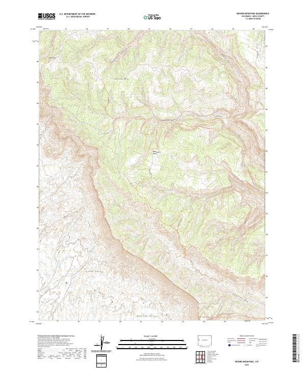
2022 Map of Round Mountain
USGS Topo · Published 2022About this map
Mt Garfield and Monument Rocks stand as the primary topographical landmarks in this high-desert landscape north of the Colorado River corridor. The terrain is defined by a dense network of drainages and canyons, including Cosgrove Canyon, Main Canyon, and Cottonwood Canyon, which carve into the expansive Pine Ridge and Grand Valley floors. This recent survey emphasizes the region's recreational and navigational infrastructure, detailing an intricate system of paths such as the Ute Trl, Hoodoo Trl, and Adobe Spring Trl. These routes traverse a landscape primarily organized by township and range boundaries, where seasonal water sources like Jerry Cr and Lewis Wash flow toward Moulton Valley. The presence of Indian Park and numerous specialized trails like the Crazy Ed Trl suggests a modern landscape where historical transit routes have evolved into a complex network of public access points.
Find a feature on this map
38 named features on this map. Tap any name to fly to it.
Don’t see what you’re looking for? This feature index may not catch every label — zoom into the map to look around manually.
Map Details
Editions of this 2022 Round Mountain Map
This is the sole edition of this map. No revisions or reprints were ever made.
Other maps of this area

1929 · Roan Creek
USGS Topo · 1:62,500

1955 · Cameo
USGS Topo · 1:24,000

1956 · Grand Junction
USGS Topo · 1:250,000

1959 · Grand Junction
USGS Topo · 1:250,000

1960 · Grand Junction
USGS Topo · 1:250,000

1962 · Grand Junction
USGS Topo · 1:250,000

1962 · Clifton
USGS Topo · 1:24,000

1962 · Grand Junction
USGS Topo · 1:24,000
1962 · Round Mountain
USGS Topo · 1:24,000

1962 · Corcoran Point
USGS Topo · 1:24,000