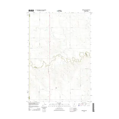
2014 Map of Round Top
USGS Topo · Published 2014About this map
Round Top stands as a prominent elevation in this northern plains landscape, situated within a region where the borders of Adams, Grant, and Sioux counties converge. The geography is defined by a dendritic drainage pattern, most notably the meandering course of Cedar Creek which carves through the central portion of the quadrangle. This 2014 survey reveals a sparse, rural settlement pattern typical of the Dakotas, where a strictly rectangular grid of section-line roads, including 91st St SW and 77th Ave SW, provides the primary framework for movement across the grassland. Several intermittent waterways, such as Timber Cr, Turtle Cr, and Alkali Cr, feed into the larger creek system, illustrating the natural water management of the plains prior to modern intensive development.
Find a feature on this map
22 named features on this map. Tap any name to fly to it.
Don’t see what you’re looking for? This feature index may not catch every label — zoom into the map to look around manually.
Map Details
Editions of this 2014 Round Top Map
This is the sole edition of this map. No revisions or reprints were ever made.
Other maps of this area

1953 · McIntosh
USGS Topo · 1:250,000

1953 · Dickinson
USGS Topo · 1:250,000

1954 · Lemmon
USGS Topo · 1:250,000

1954 · Bismarck
USGS Topo · 1:250,000

1957 · Dickinson
USGS Topo · 1:250,000

1957 · Lemmon
USGS Topo · 1:250,000

1958 · Bismarck
USGS Topo · 1:250,000

1958 · McIntosh
USGS Topo · 1:250,000

1972 · Coffin Buttes
USGS Topo · 1:24,000

1972 · Pretty Rock Butte
USGS Topo · 1:24,000
Featured Places
- Menz Township, Porcupine District
- Porcupine District, ND
- Grant County, ND
- Sioux County, ND
- Adams County, ND