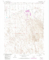
1963 Map of Round Top
USGS Topo · Published 1984About this map
Badger Creek meanders across the northern plains of Morgan County, marking a landscape where early agricultural irrigation meets modern industrial infrastructure. This survey captures the transition of the high plains, showing the path of the Old Dld Road alongside the Burlington Northern railroad. The importance of water management in this arid environment is evident in the engineered paths of the Fort Morgan Canal and the Upper Platte and Beaver Canal.
Find a feature on this map
14 named features on this map. Tap any name to fly to it.
Don’t see what you’re looking for? This feature index may not catch every label — zoom into the map to look around manually.
Map Details
Editions of this 1963 Round Top Map
2 editions found
Other maps of this area

1951 · Brush West
USGS Topo · 1:24,000

1951 · Brush East
USGS Topo · 1:24,000

1951 · Fort Morgan
USGS Topo · 1:24,000

1954 · Sterling
USGS Topo · 1:250,000

1958 · Sterling
USGS Topo · 1:250,000

1963 · Lamb
USGS Topo · 1:24,000

1963 · Round Top
USGS Topo · 1:24,000

1965 · Gary
USGS Topo · 1:24,000

1965 · Vallery SE
USGS Topo · 1:24,000

1965 · Huey Ranch
USGS Topo · 1:24,000