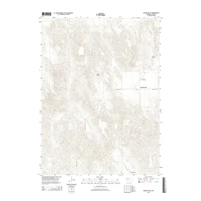
2014 Map of Round Valley
USGS Topo · Published 2014About this map
Round Valley serves as the focal point of this Custer County landscape, where the flat, agricultural basin is sharply contrasted by the surrounding loess hills. The map documents a rural Nebraska community defined by its valleys, including Sargent Valley to the north and the secluded Swiss Valley at the southern edge. The small settlement area and the nearby Round Valley Cemetery provide critical anchor points for genealogists and local historians tracking family roots in this corner of the Sandhills transition zone. Water drainage across the western half of the quadrangle is dominated by the meandering path of Lillian Creek, while the local transportation network is anchored by Round Valley Road, which links the disparate homesteads and farmsteads scattered across the terrain.
Find a feature on this map
7 named features on this map. Tap any name to fly to it.
Don’t see what you’re looking for? This feature index may not catch every label — zoom into the map to look around manually.
Map Details
Editions of this 2014 Round Valley Map
This is the sole edition of this map. No revisions or reprints were ever made.
Other maps of this area

1951 · Broken Bow NE
USGS Topo · 1:24,000

1951 · Westerville
USGS Topo · 1:24,000

1951 · Lillian
USGS Topo · 1:24,000

1951 · Broken Bow
USGS Topo · 1:24,000

1951 · Walworth
USGS Topo · 1:24,000

1951 · Round Valley
USGS Topo · 1:24,000

1951 · Milburn
USGS Topo · 1:24,000

1952 · Sargent West
USGS Topo · 1:24,000

1952 · Sargent SW
USGS Topo · 1:24,000

1955 · Broken Bow
USGS Topo · 1:250,000