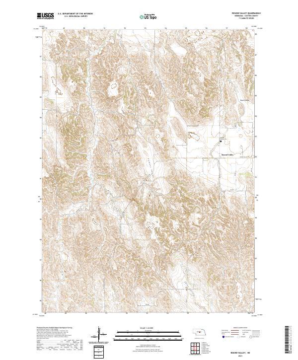
2021 Map of Round Valley
USGS Topo · Published 2021About this map
Sargent Valley and Swiss Valley define the undulating topography of this Custer County landscape, where agriculture and open rangeland predominate. The small settlement of Round Valley serves as the primary focal point in the northeast, situated near the intersection of several rural routes including Rd 811 and Round Valley Rd. Local history is anchored at the Round Valley Cem, a key landmark for genealogical research in this part of the Nebraska sandhills region. Drainage for the western portion of the map is provided by Lillian Cr, while a network of section roads like Rd 445 and Rd 447 maintains the rigid township and range grid system. The map reflects a modern era of land management, documenting the enduring rural character of these valleys through their established road networks and sparse but significant communal landmarks.
Find a feature on this map
22 named features on this map. Tap any name to fly to it.
Don’t see what you’re looking for? This feature index may not catch every label — zoom into the map to look around manually.
Map Details
Editions of this 2021 Round Valley Map
This is the sole edition of this map. No revisions or reprints were ever made.
Other maps of this area

1951 · Broken Bow NE
USGS Topo · 1:24,000

1951 · Westerville
USGS Topo · 1:24,000

1951 · Lillian
USGS Topo · 1:24,000

1951 · Broken Bow
USGS Topo · 1:24,000

1951 · Walworth
USGS Topo · 1:24,000

1951 · Round Valley
USGS Topo · 1:24,000

1951 · Milburn
USGS Topo · 1:24,000

1952 · Sargent West
USGS Topo · 1:24,000

1952 · Sargent SW
USGS Topo · 1:24,000

1955 · Broken Bow
USGS Topo · 1:250,000