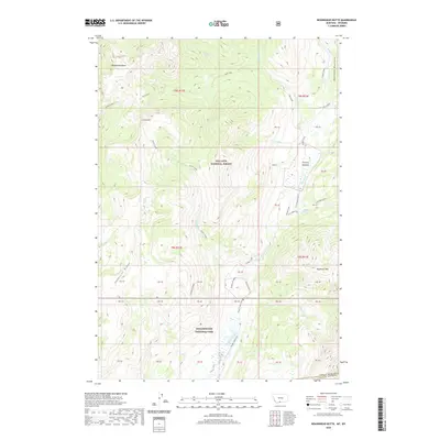
2020 Map of Roundhead Butte
USGS Topo · Published 2020About this map
Gallatin National Forest and Yellowstone National Park converge in this high-elevation wilderness near the border of Montana and Wyoming. The landscape is defined by the sharp verticality of the Beartooth Mountains, where prominent summits like Roundhead Butte and Lookout Mtn overlook a complex drainage system. The central drainage of Slough Creek serves as a primary corridor through the area, supported by the Slough Creek Trail and the Lost Creek Cutoff. These paths trace the natural breaks in the topography, connecting the open stretches of Frenchy Meadow with the high timber of Anderson Ridge. The map illustrates a preserved environment where the primary markers are natural features and established pack trails rather than modern roads, documenting the unchanged character of the backcountry in the early twenty-first century.
Find a feature on this map
75 named features on this map. Tap any name to fly to it.
Don’t see what you’re looking for? This feature index may not catch every label — zoom into the map to look around manually.
Map Details
Editions of this 2020 Roundhead Butte Map
This is the sole edition of this map. No revisions or reprints were ever made.
Other maps of this area

1886 · Canyon
USGS Topo · 1:125,000

1891 · Livingston
USGS Topo · 1:250,000

1893 · Livingston
USGS Topo · 1:250,000

1895 · Canyon
USGS Topo · 1:125,000

1896 · Canyon
USGS Topo · 1:125,000

1901 · Canyon
USGS Topo · 1:125,000

1907 · Canyon
USGS Topo · 1:125,000

1911 · Canyon
USGS Topo · 1:125,000

1940 · Mt Wallace
USGS Topo · 1:62,500

1942 · Cutoff Mtn
USGS Topo · 1:62,500