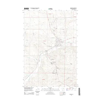
2014 Map of Roundup
USGS Topo · Published 2014About this map
The Musselshell River carves a winding path through this Montana landscape, anchoring a series of small communities and industrial sites in Musselshell County. The city of Roundup serves as the primary hub, situated near the junction of Us-12 and Us-87. Evidence of the region’s coal mining legacy is etched into the landscape, notably with the United Mine Workers of America Cem and roads such as Mushroom Mine Rd and 2 Mine Rd. Small settlements like Klein, Farrelltown, and Gibbtown are clustered south of the river along the valley floor, connected by a network of local routes including Valley Rd and Mine Rd. The topography is defined by significant drainage features such as Deadman Coulee and Fletchers Coulee, which cut through the high ground of the Roundup Mesa area. This 2014 survey documents the enduring spatial relationship between the river, the historic mining towns, and the transportation corridors that define this part of the Big Sky Country.
Find a feature on this map
80 named features on this map. Tap any name to fly to it.
Don’t see what you’re looking for? This feature index may not catch every label — zoom into the map to look around manually.
Map Details
Editions of this 2014 Roundup Map
This is the sole edition of this map. No revisions or reprints were ever made.
Other maps of this area

1954 · Roundup
USGS Topo · 1:250,000

1958 · Roundup
USGS Topo · 1:250,000

1979 · Roundup
USGS Topo · 1:100,000

1979 · Harper Coulee
USGS Topo · 1:24,000

1979 · Elso
USGS Topo · 1:24,000

1979 · Horsethief Creek
USGS Topo · 1:24,000

1979 · Gage
USGS Topo · 1:24,000

1979 · Roundup
USGS Topo · 1:24,000

1980 · Signal Mountain
USGS Topo · 1:24,000

1986 · Lake Mason SE
USGS Topo · 1:24,000