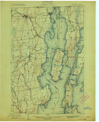
1907 Map of Rouses Point
USGS Topo · Published 1913About this map
Fort Montgomery stands at the northern edge of this Lake Champlain survey, guarding the waters near the Dominion of Canada border. The landscape is defined by the intricate maritime and rail corridors of the late 19th century, where the Rutland and Central Vermont railroads cross the lake to connect Alburg and Rouses Point. On the New York shore, the Big Chazy River winds through Champlain and Chazy toward the bay, while the Delaware and Hudson line services inland settlements like Beekmantown.
Find a feature on this map
113 named features on this map. Tap any name to fly to it.
Don’t see what you’re looking for? This feature index may not catch every label — zoom into the map to look around manually.
Map Details
Editions of this 1907 Rouses Point Map
5 editions found
Other maps of this area

1894 · Plattsburg
USGS Topo · 1:62,500

1895 · Mooers
USGS Topo · 1:62,500

1895 · Rouse Point
USGS Topo · 1:62,500

1899 · Mooers
USGS Topo · 1:62,500

1906 · Plattsburg
USGS Topo · 1:62,500

1907 · Rouse Point
USGS Topo · 1:62,500

1913 · Dannemora
USGS Topo · 1:62,500

1913 · Milton
USGS Topo · 1:48,000

1914 · St. Albans
USGS Topo · 1:48,000

1915 · Milton
USGS Topo · 1:62,500