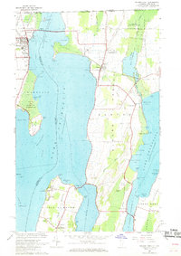
1966 Map of Rouses Point
USGS Topo · Published 1968About this map
Fort Montgomery Ruins stand guard over the upper reaches of the Richelieu River, marking a point of historic tension and trade along the international border with Canada. This mid-century survey illustrates the intricate geography of the Lake Champlain islands and the Alburg Tongue, where the New York and Vermont state lines meet in open water. The map documents the religious and cultural focal points of the area, including the St Annes Shrine and St Josephs Ch on Isle La Motte.
Find a feature on this map
84 named features on this map. Tap any name to fly to it.
Don’t see what you’re looking for? This feature index may not catch every label — zoom into the map to look around manually.
Map Details
Editions of this 1966 Rouses Point Map
This is the sole edition of this map. No revisions or reprints were ever made.
Other maps of this area

1895 · Rouse Point
USGS Topo · 1:62,500

1907 · Rouse Point
USGS Topo · 1:62,500

1914 · St. Albans
USGS Topo · 1:48,000

1916 · St. Albans
USGS Topo · 1:62,500

1939 · Rouses Point
USGS Topo · 1:62,500

1943 · Rouses Point
USGS Topo · 1:62,500

1943 · St. Albans
USGS Topo · 1:62,500

1950 · Lake Champlain
USGS Topo · 1:250,000

1956 · Rouses Point
USGS Topo · 1:62,500

1958 · Lake Champlain
USGS Topo · 1:250,000