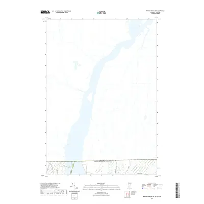
2021 Map of Rouses Point OE N
USGS Topo · Published 2021About this map
The Richelieu River dominates this international borderland, serving as the primary drainage for Lake Champlain as it flows north into Quebec. Located at the northernmost edge of Clinton County, the village of Rouses Point is mapped just below the line of the Canada United States of America border. This modern survey illustrates the current transport infrastructure and boundary intersections where New York and Vermont meet at the water's edge. The rural landscape east of the river is defined by local routes such as Border Rd and Blair Rd, which navigate the wetlands and agricultural tracts typical of the Lake Champlain basin. Researchers will find precise alignment for state and county divisions, including the meeting of Clinton and Grand Isle counties across the channel.
Find a feature on this map
10 named features on this map. Tap any name to fly to it.
Don’t see what you’re looking for? This feature index may not catch every label — zoom into the map to look around manually.
Map Details
Editions of this 2021 Rouses Point OE N Map
This is the sole edition of this map. No revisions or reprints were ever made.
Other maps of this area

1895 · Rouse Point
USGS Topo · 1:62,500

1907 · Rouse Point
USGS Topo · 1:62,500

1914 · St. Albans
USGS Topo · 1:48,000

1916 · St. Albans
USGS Topo · 1:62,500

1939 · Rouses Point
USGS Topo · 1:62,500

1943 · Rouses Point
USGS Topo · 1:62,500

1943 · St. Albans
USGS Topo · 1:62,500

1950 · Lake Champlain
USGS Topo · 1:250,000

1956 · Rouses Point
USGS Topo · 1:62,500

1958 · Lake Champlain
USGS Topo · 1:250,000