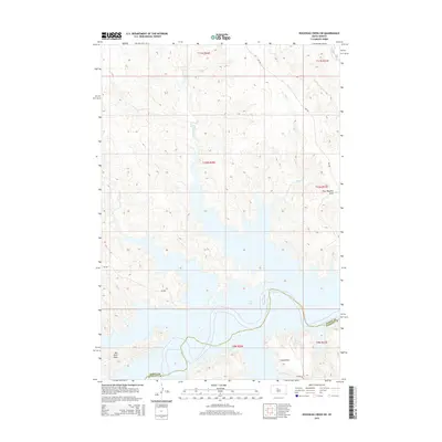
2015 Map of Rousseau Creek SW
USGS Topo · Published 2015About this map
Lake Oahe dominates this central South Dakota landscape, where the Missouri River's impoundment creates a complex, branching shoreline along the boundary of Dewey Co and Stanley County. The terrain is defined by a series of drainages including Fishgut Cr, Sage Cr, and Paradis Cr, which carve through the plains toward the reservoir. These seasonal watercourses dictate the local geography, leading into distinctive landforms such as Fine Weather Draw. In the southern reaches, the elevation levels out into broad areas known as Kid Rich Flats and Little Flats. Transportation is sparse, relying on Bureau of Indian Affairs routes like Bia-802 and Bia-803, reflecting the rural character of this region within the Cheyenne River Reservation area during the early twenty-first century.
Find a feature on this map
18 named features on this map. Tap any name to fly to it.
Don’t see what you’re looking for? This feature index may not catch every label — zoom into the map to look around manually.
Map Details
Editions of this 2015 Rousseau Creek SW Map
This is the sole edition of this map. No revisions or reprints were ever made.
Other maps of this area

1954 · Pierre
USGS Topo · 1:250,000

1956 · Rousseau Creek SW
USGS Topo · 1:24,000

1956 · Herbert Creek SE
USGS Topo · 1:24,000

1956 · Sansarc NE
USGS Topo · 1:24,000

1956 · Crockett Mountains
USGS Topo · 1:24,000

1958 · Pierre
USGS Topo · 1:250,000

1969 · Rousseau Creek
USGS Topo · 1:24,000

1981 · Charlie Creek
USGS Topo · 1:24,000

1981 · Rousseau Creek NW
USGS Topo · 1:24,000

1981 · Herbert Creek NE
USGS Topo · 1:24,000