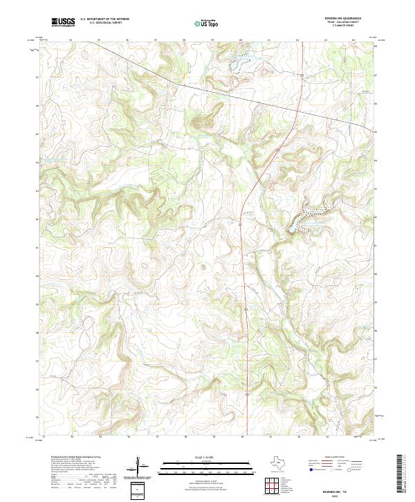
2022 Map of Rowden NW
USGS Topo · Published 2022About this map
Pecan Bayou and its numerous branches dominate this portion of Callahan County, revealing a landscape defined by water management and drainage. The convergence of the N Prong Pecan Bayou and S Prong Pecan Bayou highlights a complex network of seasonal creeks, including Clear Cr, Bear Br, and the oddly named Condemn Br. This area is characterized by significant agricultural infrastructure, specifically multiple Soil Conservation Service projects. Large reservoirs such as Soil Conservation Service Site 12 Reservoir and Soil Conservation Service Site 10 Reservoir illustrate mid-to-late 20th-century efforts to control runoff and support ranching operations in the Texas Rolling Plains. The map also documents a web of private access roads and county routes like Co RD 479 and FM 2926, which connect the isolated homesteads and pastures typical of this rural region.
Find a feature on this map
19 named features on this map. Tap any name to fly to it.
Don’t see what you’re looking for? This feature index may not catch every label — zoom into the map to look around manually.
Map Details
Editions of this 2022 Rowden NW Map
This is the sole edition of this map. No revisions or reprints were ever made.
Other maps of this area

1890 · Abilene
USGS Topo · 1:125,000

1892 · Abilene
USGS Topo · 1:125,000

1931 · Baird
USGS Topo · 1:125,000

1932 · Baird
USGS Topo · 1:125,000

1954 · Abilene
USGS Topo · 1:250,000

1957 · Kirby Lake
USGS Topo · 1:62,500

1958 · Abilene
USGS Topo · 1:250,000
1960 · Webbville
USGS Topo · 1:24,000
1960 · Crooked Creek
USGS Topo · 1:24,000

1966 · Admiral
USGS Topo · 1:24,000