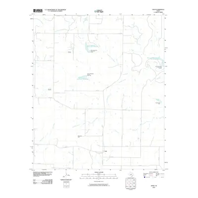
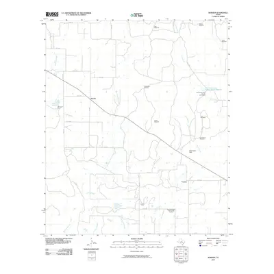
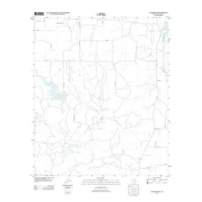
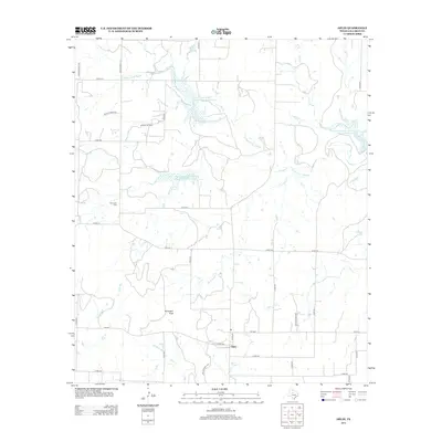
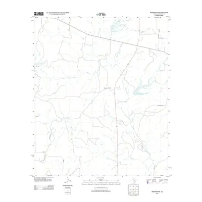
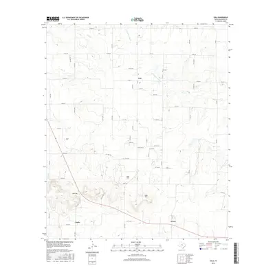
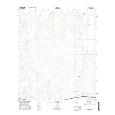
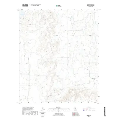
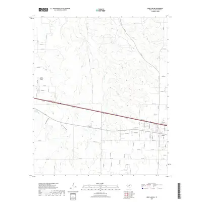
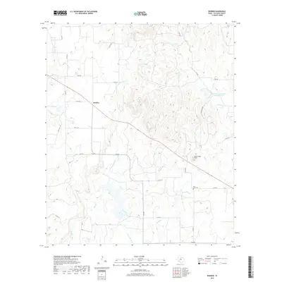
1968 Map of Rowden NW
USGS Topo · Published 1987About this map
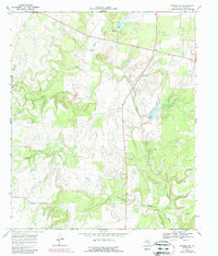
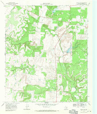
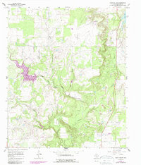
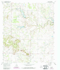
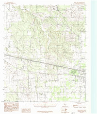
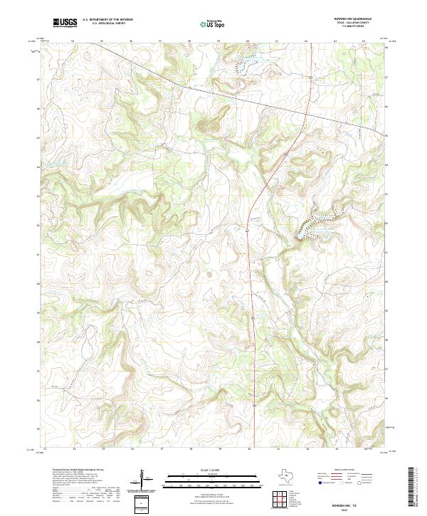
Pecan Bayou and its numerous tributaries, including Clear Creek and Condemn Branch, define the drainage patterns of this Callahan County landscape as it was documented in the late 1960s. The terrain is a network of small watersheds, where cattle ranching and resource extraction coexist with the emerging highway system of West Texas. Industrial activity is concentrated in the southern and central portions of the sheet, marked by several Gravel Pits and a cluster of Oil Wells. Small-scale aviation and traveler infrastructure appear in the form of a remote Landing Strip and a Roadside Park along the highway, illustrating the mid-century reliance on both private flight and automobile travel in this expansive region. The presence of a Drill Hole and a marked Pipeline further indicates the area's importance to the regional energy economy.
Find a feature on this map
12 named features on this map. Tap any name to fly to it.
Don’t see what you’re looking for? This feature index may not catch every label — zoom into the map to look around manually.
Map Details
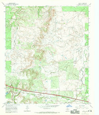
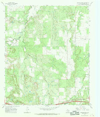
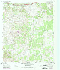
Editions of this 1968 Rowden NW Map
2 editions found
Historical Maps of Callahan County Through Time
67 maps found
1957 Kirby Lake
Callahan County, TX
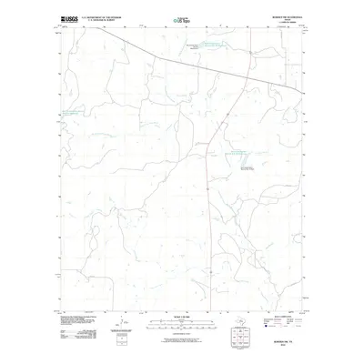
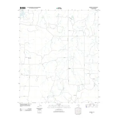
1966 Admiral
Callahan County, TX
1966 Club Hollow
Callahan County, TX
1966 Jayell
Callahan County, TX
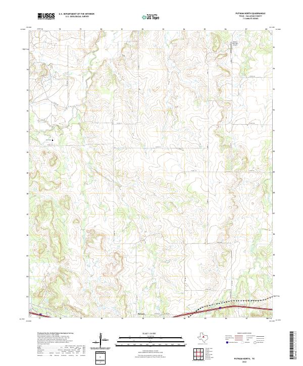
1966 Putnam North
Callahan County, TX
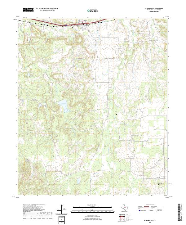
1966 Putnam South
Callahan County, TX
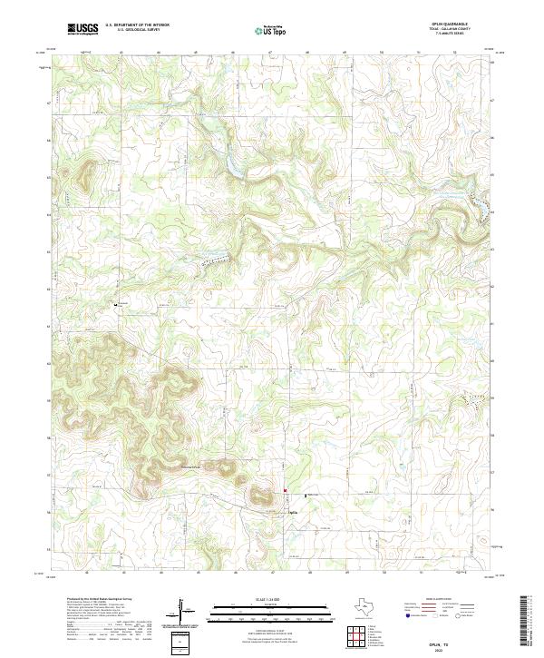
1967 Oplin
Callahan County, TX
1968 Cross Plains North
Callahan County, TX
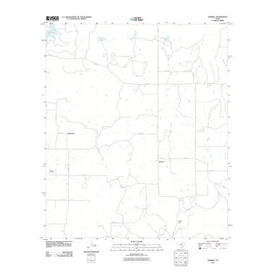
1968 Rowden
Callahan County, TX
1968 Rowden NW
Callahan County, TX
1984 Eula
Callahan County, TX
1984 Kirby Lake NE
Callahan County, TX
2010 Club Hollow
Callahan County, TX
2010 Cross Plains North
Callahan County, TX
2010 Eula
Callahan County, TX
2010 Jayell
Callahan County, TX
2010 Kirby Lake NE
Callahan County, TX
2010 Oplin
Callahan County, TX

2010 Putnam North
Callahan County, TX
2010 Putnam South
Callahan County, TX
2010 Rowden
Callahan County, TX
2010 Rowden NW
Callahan County, TX
2011 Admiral
Callahan County, TX
2012 Admiral
Callahan County, TX
2012 Club Hollow
Callahan County, TX
2012 Cross Plains North
Callahan County, TX
2012 Eula
Callahan County, TX
2012 Jayell
Callahan County, TX

2012 Kirby Lake NE
Callahan County, TX
2012 Oplin
Callahan County, TX
2012 Putnam North
Callahan County, TX
2012 Putnam South
Callahan County, TX
2012 Rowden
Callahan County, TX
2012 Rowden NW
Callahan County, TX
2016 Admiral
Callahan County, TX
2016 Club Hollow
Callahan County, TX
2016 Cross Plains North
Callahan County, TX
2016 Eula
Callahan County, TX
2016 Jayell
Callahan County, TX
2016 Kirby Lake NE
Callahan County, TX
2016 Oplin
Callahan County, TX
2016 Putnam North
Callahan County, TX
2016 Putnam South
Callahan County, TX
2016 Rowden
Callahan County, TX
2016 Rowden NW
Callahan County, TX
2019 Admiral
Callahan County, TX
2019 Club Hollow
Callahan County, TX
2019 Cross Plains North
Callahan County, TX

2019 Eula
Callahan County, TX
2019 Jayell
Callahan County, TX
2019 Kirby Lake NE
Callahan County, TX
2019 Oplin
Callahan County, TX
2019 Putnam North
Callahan County, TX
2019 Putnam South
Callahan County, TX
2019 Rowden
Callahan County, TX
2019 Rowden NW
Callahan County, TX
2022 Admiral
Callahan County, TX
2022 Club Hollow
Callahan County, TX
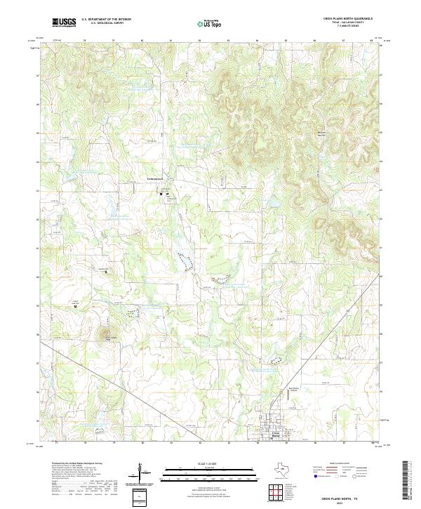
2022 Cross Plains North
Callahan County, TX
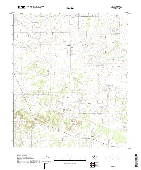
2022 Eula
Callahan County, TX
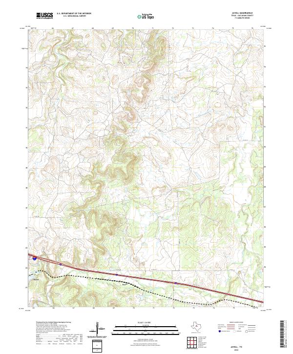
2022 Jayell
Callahan County, TX
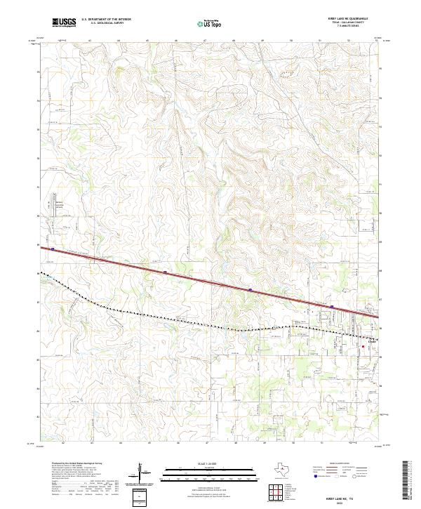
2022 Kirby Lake NE
Callahan County, TX
2022 Oplin
Callahan County, TX
2022 Putnam North
Callahan County, TX
2022 Putnam South
Callahan County, TX
2022 Rowden
Callahan County, TX
2022 Rowden NW
Callahan County, TX