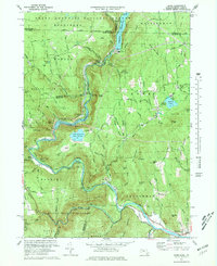
1973 Map of Rowe
USGS Topo · Published 1978About this map
Monroe Bridge and the village of Rowe anchor this 1970s landscape where industry and conservation meet along the Deerfield River. The map highlights a significant energy corridor, featuring the Sherman Reservoir, Lower Reservoir, and the Upper Reservoir Bear Swamp, supported by the Sherman Dam and multiple substations. This industrial footprint is balanced by the extensive woodlands of the Monroe State Forest and Mohawk Trail State Forest, which preserve the steep terrain around Spruce Mtn and Negus Mtn.
Find a feature on this map
117 named features on this map. Tap any name to fly to it.
Don’t see what you’re looking for? This feature index may not catch every label — zoom into the map to look around manually.
Map Details
Editions of this 1973 Rowe Map
4 editions found
Other maps of this area

1886 · Greylock
USGS Topo · 1:62,500

1886 · Hawley
USGS Topo · 1:62,500

1889 · Wilmington
USGS Topo · 1:62,500

1890 · Hawley
USGS Topo · 1:62,500

1891 · Wilmington
USGS Topo · 1:62,500

1891 · Greylock
USGS Topo · 1:62,500

1893 · Greylock
USGS Topo · 1:62,500

1894 · Hawley
USGS Topo · 1:62,500

1898 · Bennington
USGS Topo · 1:62,500

1898 · Greylock
USGS Topo · 1:62,500