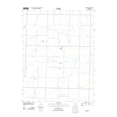
2012 Map of Rowena
USGS Topo · Published 2012About this map
Rowena anchors this agricultural landscape in Audrain County, where a complex network of county roads like Audrain Road 209 and Audrain Road 248 dissects the Missouri prairie. The terrain is defined by a dendritic drainage system where Youngs Creek, Goodwater Creek, and Long Branch move through the central and northern sections. The map reveals a specific pattern of land use centered on private water management, evidenced by numerous named earthen structures such as the Sprock Farms Incorporated Lake Dam, Donaldson Lake Dam, and Sudbrock Lake Dam. These landmarks, often tied to local family names like Henry or Cook, provide a detailed look at the rural infrastructure required to support the region's farming economy in the early 21st century.
Find a feature on this map
48 named features on this map. Tap any name to fly to it.
Don’t see what you’re looking for? This feature index may not catch every label — zoom into the map to look around manually.
Map Details
Editions of this 2012 Rowena Map
This is the sole edition of this map. No revisions or reprints were ever made.
Other maps of this area

1890 · Mexico
USGS Topo · 1:125,000

1890 · Moberly
USGS Topo · 1:125,000

1932 · Mexico
USGS Topo · 1:62,500

1945 · Florida
USGS Topo · 1:62,500

1945 · Centralia
USGS Topo · 1:62,500

1948 · Quincy
USGS Topo · 1:250,000

1953 · Moberly
USGS Topo · 1:250,000

1954 · Moberly
USGS Topo · 1:250,000

1956 · Quincy
USGS Topo · 1:250,000

1957 · Moberly
USGS Topo · 1:250,000