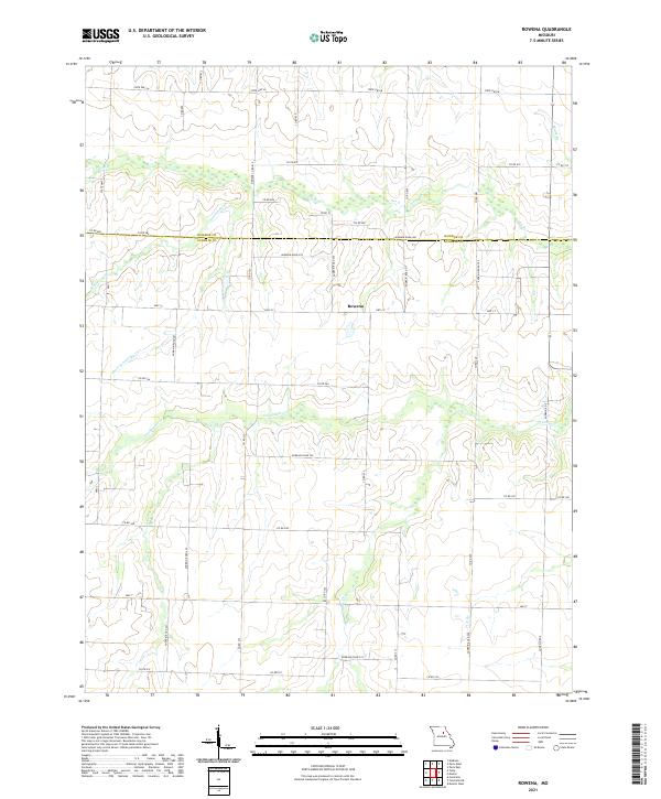
2021 Map of Rowena
USGS Topo · Published 2021About this map
The settlement of Rowena serves as the focal point of this agricultural landscape along the Monroe Co Audrain Co border. Situated along Hwy CC, the village is surrounded by a complex network of county roads, including Audrain Road 280 and Audrain Road 225, which provide access to the surrounding farms. The terrain is defined by a series of south-flowing drainage systems, most notably Goodwater Cr and Youngs Cr in the central and eastern sections, while Scattering Br and Short Scattering Cr drain the western reaches. This 2021 survey illustrates a well-established rural infrastructure, where modern state highways like State Hwy M and Hwy T overlay the traditional grid of property lines and section corners, reflecting the long-term agrarian character of the Audrain and Monroe County borderlands.
Find a feature on this map
45 named features on this map. Tap any name to fly to it.
Don’t see what you’re looking for? This feature index may not catch every label — zoom into the map to look around manually.
Map Details
Editions of this 2021 Rowena Map
This is the sole edition of this map. No revisions or reprints were ever made.
Other maps of this area

1890 · Mexico
USGS Topo · 1:125,000

1890 · Moberly
USGS Topo · 1:125,000

1932 · Mexico
USGS Topo · 1:62,500

1945 · Florida
USGS Topo · 1:62,500

1945 · Centralia
USGS Topo · 1:62,500

1948 · Quincy
USGS Topo · 1:250,000

1953 · Moberly
USGS Topo · 1:250,000

1954 · Moberly
USGS Topo · 1:250,000

1956 · Quincy
USGS Topo · 1:250,000

1957 · Moberly
USGS Topo · 1:250,000