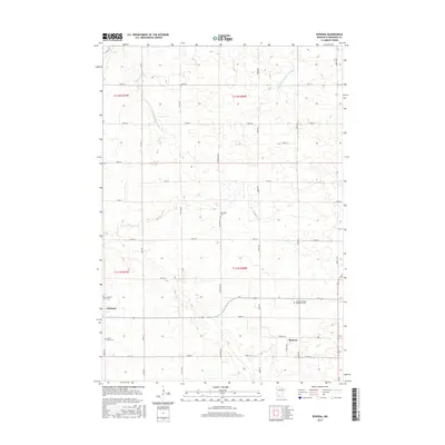
2016 Map of Rowena
USGS Topo · Published 2016About this map
Agricultural plains and organized water management define this landscape in Redwood County. The settlement of Wabasso sits on the western edge of the quadrangle, while the smaller community of Rowena occupies the southeastern corner. This region is characterized by a precise grid of rural roads, such as Knox Ave and 260th St, which partition the land into productive farm plots. Significant engineering for irrigation and drainage is evident through named waterways like Judicial Ditch Number Five and County Ditch Number Fiftytwo. For those tracing local heritage, several burial grounds are scattered throughout the township, including the New Avon Cem and the New Avon Salem Methodist Cem, providing a clear record of the area's established rural congregations and historical settlement patterns near Wabasha Cr.
Find a feature on this map
33 named features on this map. Tap any name to fly to it.
Don’t see what you’re looking for? This feature index may not catch every label — zoom into the map to look around manually.
Map Details
Editions of this 2016 Rowena Map
This is the sole edition of this map. No revisions or reprints were ever made.
Other maps of this area

1952 · Redwood Falls
USGS Topo · 1:62,500

1953 · New Ulm
USGS Topo · 1:250,000

1957 · New Ulm
USGS Topo · 1:250,000

1958 · New Ulm
USGS Topo · 1:250,000

1965 · Belview
USGS Topo · 1:24,000

1967 · New Ulm
USGS Topo · 1:250,000

1967 · Wanda
USGS Topo · 1:24,000

1967 · Clements
USGS Topo · 1:24,000

1967 · Wabasso SE
USGS Topo · 1:24,000

1967 · Wabasso
USGS Topo · 1:24,000