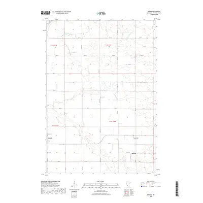
2019 Map of Rowena
USGS Topo · Published 2019About this map
Wabasso and the smaller settlement of Rowena anchor this landscape in Redwood County, where agricultural land is defined by a grid of rural roads and an extensive water management system. The map documents a drainage network essential to the region's farming heritage, featuring the Judicial Ditch Number Five, County Ditch Number Fiftytwo, and the meandering path of Wabasha Cr. For those researching local history or genealogy, the area contains several significant burial sites, including New Avon Cem, Bethany Cem, and the Saint Anns Cem on the outskirts of Wabasso. Near the eastern edge, the New Avon Salem Methodist Cem sits at a crossroads, serving as a quiet landmark in this prairie landscape. The strict section-line orientation of roads like Kenwood Ave and Knox Ave illustrates the enduring influence of the Public Land Survey System on Minnesota's development.
Find a feature on this map
35 named features on this map. Tap any name to fly to it.
Don’t see what you’re looking for? This feature index may not catch every label — zoom into the map to look around manually.
Map Details
Editions of this 2019 Rowena Map
This is the sole edition of this map. No revisions or reprints were ever made.
Other maps of this area

1952 · Redwood Falls
USGS Topo · 1:62,500

1953 · New Ulm
USGS Topo · 1:250,000

1957 · New Ulm
USGS Topo · 1:250,000

1958 · New Ulm
USGS Topo · 1:250,000

1965 · Belview
USGS Topo · 1:24,000

1967 · New Ulm
USGS Topo · 1:250,000

1967 · Wanda
USGS Topo · 1:24,000

1967 · Clements
USGS Topo · 1:24,000

1967 · Wabasso SE
USGS Topo · 1:24,000

1967 · Wabasso
USGS Topo · 1:24,000