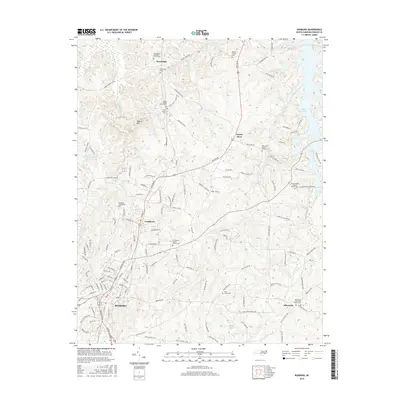
2016 Map of Roxboro
USGS Topo · Published 2016About this map
The city of Roxboro serves as the central hub of this 2016 survey, with its urban grid transitioning into the rural reaches of Person County. To the north and east, the landscape is defined by a series of long-established congregational centers, including Woodsdale Methodist Church and Mill Creek Baptist Church, each with an adjacent cemetery reflecting generations of local residency. The eastern boundary is marked by the expansive waters of the Mayo Reservoir, which creates a complex shoreline of coves fed by local drainage such as Mill Cr and Mitchell Cr. In the northern uplands, Hagers Mtn rises above the surrounding farmland, while small crossroads like Gentry Store and the community of Allensville illustrate the persistent settlement patterns of the North Carolina Piedmont. This documentation includes numerous family-named landmarks, from the Allen Family Cem to various rural churchyards, offering significant detail for genealogical research.
Find a feature on this map
148 named features on this map. Tap any name to fly to it.
Don’t see what you’re looking for? This feature index may not catch every label — zoom into the map to look around manually.
Map Details
Editions of this 2016 Roxboro Map
This is the sole edition of this map. No revisions or reprints were ever made.
Other maps of this area

1943 · Roxboro
USGS Topo · 1:62,500

1952 · Milton
USGS Topo · 1:62,500

1953 · South Boston
USGS Topo · 1:62,500

1953 · Greensboro
USGS Topo · 1:250,000

1954 · Greensboro
USGS Topo · 1:250,000

1956 · Milton
USGS Topo · 1:62,500

1957 · South Boston
USGS Topo · 1:62,500

1962 · Greensboro
USGS Topo · 1:250,000

1966 · Greensboro
USGS Topo · 1:250,000

1968 · Hurdle Mills
USGS Topo · 1:24,000