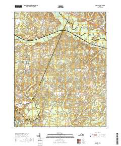
2019 Map of Roxbury
USGS Topo · Published 2019About this map
Glendale National Cemetery and segments of the Richmond National Battlefield Park anchor this landscape, marking significant sites of Civil War history where the Tidewater terrain meets the coastal plain. The Chickahominy River winds along the eastern boundary, flanked by the sprawling Toe Ink Swamp and White Oak Swamp, which have historically dictated the placement of roads and settlements. Small communities and landmarks like Ednas Mill, Roxbury, and Malvern Hill are connected by a network of rural routes including Charles City Rd and Elko Rd. The presence of several historic burial grounds, such as Mount Pleasant Cem and Salem Cem, provides important touchpoints for genealogists and local historians tracing families in this area of Henrico and Charles City counties.
Find a feature on this map
118 named features on this map. Tap any name to fly to it.
Don’t see what you’re looking for? This feature index may not catch every label — zoom into the map to look around manually.
Map Details
Editions of this 2019 Roxbury Map
This is the sole edition of this map. No revisions or reprints were ever made.
Other maps of this area

1894 · Bermuda Hundred
USGS Topo · 1:62,500

1894 · Richmond
USGS Topo · 1:62,500

1895 · Richmond
USGS Topo · 1:62,500

1918 · Charles City
USGS Topo · 1:62,500

1920 · King William
USGS Topo · 1:62,500

1934 · Seven Pines
USGS Topo · 1:24,000

1938 · Dutch Gap
USGS Topo · 1:24,000

1938 · Seven Pines
USGS Topo · 1:31,680

1943 · Dutch Gap
USGS Topo · 1:31,680

1943 · Hopewell
USGS Topo · 1:31,680