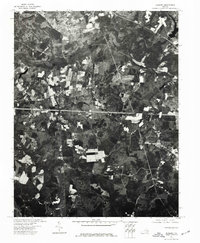
1974 Map of Roxbury
USGS Topo · Published 1977About this map
The small settlement of Roxbury serves as the focal point for this orthophotoquad in Charles City County. Produced from aerial photography taken in the mid-1970s, the imagery reveals a landscape defined by an intricate patchwork of cultivated fields and dense woodland. This specific aerial perspective captures the rural land-use patterns of the Virginia Peninsula during a period when agricultural tracts remained well-defined against the encroachment of surrounding timber. The road network and clearing patterns suggest a legacy of timber harvesting and farming that has long characterized this portion of the Tidewater region.
Find a feature on this map
1 named feature on this map. Tap any name to fly to it.
Don’t see what you’re looking for? This feature index may not catch every label — zoom into the map to look around manually.
Map Details
Editions of this 1974 Roxbury Map
This is the sole edition of this map. No revisions or reprints were ever made.
Other maps of this area

1894 · Bermuda Hundred
USGS Topo · 1:62,500

1894 · Richmond
USGS Topo · 1:62,500

1895 · Richmond
USGS Topo · 1:62,500

1918 · Charles City
USGS Topo · 1:62,500

1920 · King William
USGS Topo · 1:62,500

1934 · Seven Pines
USGS Topo · 1:24,000

1938 · Dutch Gap
USGS Topo · 1:24,000

1938 · Seven Pines
USGS Topo · 1:31,680

1943 · Dutch Gap
USGS Topo · 1:31,680

1943 · Hopewell
USGS Topo · 1:31,680