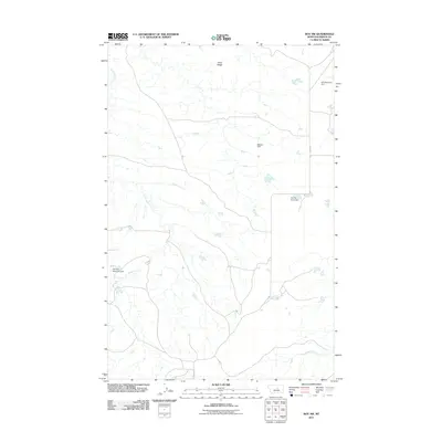
2011 Map of Roy NW
USGS Topo · Published 2011About this map
Sacagawea River winds across the southern reaches of this Fergus County landscape, anchoring a complex system of seasonal drainages and local water management. The area is defined by its agricultural infrastructure, with multiple earthen structures like Fink Reservoir Dam and the humorously named Too Far Gone Dam indicating the vital importance of water storage in this semi-arid environment. The terrain rises toward the north at Snell Ridge, while the drainage of Dry Armells Creek carves through the central portion of the map. Local transit is concentrated along Mabee Rd and Maybee Rd, providing a look at the rural property boundaries and ranch access points as they existed in the early 21st century.
Find a feature on this map
9 named features on this map. Tap any name to fly to it.
Don’t see what you’re looking for? This feature index may not catch every label — zoom into the map to look around manually.
Map Details
Editions of this 2011 Roy NW Map
This is the sole edition of this map. No revisions or reprints were ever made.
Other maps of this area

1943 · Landusky
USGS Topo · 1:125,000

1954 · Lewistown
USGS Topo · 1:250,000

1959 · Lewistown
USGS Topo · 1:250,000

1978 · Lewistown
USGS Topo · 1:100,000

1984 · Zortman
USGS Topo · 1:100,000

1985 · Griffee Coulee
USGS Topo · 1:24,000

1985 · Thompson Coulee
USGS Topo · 1:24,000

1985 · Fergus
USGS Topo · 1:24,000
1985 · Mitchell Crossing
USGS Topo · 1:24,000

1985 · Roy
USGS Topo · 1:24,000