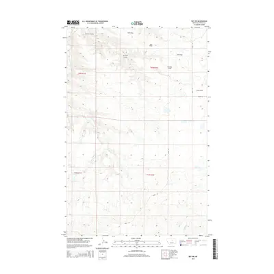
2014 Map of Roy NW
USGS Topo · Published 2014About this map
Snell Ridge dominates the northern elevation of this Fergus County landscape, where the high plains are carved by a complex network of seasonal drainages. In the south, the Sacagawea River cuts through the territory, a vital water source for the ranching operations that define this region of Montana. The map illustrates a sparse but deliberate infrastructure, where local travel depends on routes like Mabee Rd and Birdwell Ln to navigate the undulating terrain. Drainage patterns are clearly defined by features such as Antelope Coulee, Fargo Coulee, and the winding path of Dry Armells Cr. This survey captures the characteristic wide-open land use of the early 21st century, showing how township and range lines like t20n r21e and t20n r22e impose a human grid upon the natural contours of the Montana breaks.
Find a feature on this map
11 named features on this map. Tap any name to fly to it.
Don’t see what you’re looking for? This feature index may not catch every label — zoom into the map to look around manually.
Map Details
Editions of this 2014 Roy NW Map
This is the sole edition of this map. No revisions or reprints were ever made.
Other maps of this area

1943 · Landusky
USGS Topo · 1:125,000

1954 · Lewistown
USGS Topo · 1:250,000

1959 · Lewistown
USGS Topo · 1:250,000

1978 · Lewistown
USGS Topo · 1:100,000

1984 · Zortman
USGS Topo · 1:100,000

1985 · Griffee Coulee
USGS Topo · 1:24,000

1985 · Thompson Coulee
USGS Topo · 1:24,000

1985 · Fergus
USGS Topo · 1:24,000
1985 · Mitchell Crossing
USGS Topo · 1:24,000

1985 · Roy
USGS Topo · 1:24,000