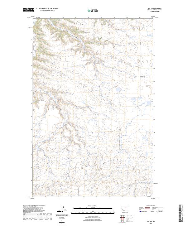
2024 Map of Roy NW
USGS Topo · Published 2024About this map
Snell Ridge dominates the northern horizon of this Fergus County landscape, where the high plains are carved by the intricate drainage systems of Antelope Coulee and Dry Armells Creek. This contemporary survey captures the sparsely populated ranching country of Central Montana, defined by large-scale section boundaries and the winding course of the Sacagawea River along the southern edge. The map traces the essential artery of Mabee Rd as it moves through the open terrain, connecting the scattered operations of this rural expanse. This view serves as a modern baseline for understanding the land use and hydrography of the Roy area, documenting the persistence of traditional cattle country in the 21st century.
Find a feature on this map
10 named features on this map. Tap any name to fly to it.
Don’t see what you’re looking for? This feature index may not catch every label — zoom into the map to look around manually.
Map Details
Editions of this 2024 Roy NW Map
This is the sole edition of this map. No revisions or reprints were ever made.
Other maps of this area

1943 · Landusky
USGS Topo · 1:125,000

1954 · Lewistown
USGS Topo · 1:250,000

1959 · Lewistown
USGS Topo · 1:250,000

1978 · Lewistown
USGS Topo · 1:100,000

1984 · Zortman
USGS Topo · 1:100,000

1985 · Griffee Coulee
USGS Topo · 1:24,000

1985 · Thompson Coulee
USGS Topo · 1:24,000

1985 · Fergus
USGS Topo · 1:24,000
1985 · Mitchell Crossing
USGS Topo · 1:24,000

1985 · Roy
USGS Topo · 1:24,000