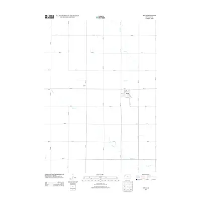
2013 Map of Royal
USGS Topo · Published 2013About this map
The town of Royal serves as the primary hub of this agricultural landscape in Clay County, Iowa, as documented in 2013. The map details the precise street grid of the village, including Main St, Meadow St, and Market St, which anchor the local community. Beyond the town limits, the terrain is defined by a strictly rectilinear network of section-line roads, such as 150th Ave and 400th St, characteristic of the Midwestern township and range survey system. Natural drainage patterns interrupt this grid, with the winding paths of Willow Cr and Spring Cr meandering through the productive farmland. Small identified localities like Ingleville and TriMello reflect the distributed nature of early 21st-century rural Iowa, where named crossroads continue to mark the geography of the prairie.
Find a feature on this map
29 named features on this map. Tap any name to fly to it.
Don’t see what you’re looking for? This feature index may not catch every label — zoom into the map to look around manually.
Map Details
Editions of this 2013 Royal Map
This is the sole edition of this map. No revisions or reprints were ever made.
Other maps of this area

1954 · Fairmont
USGS Topo · 1:250,000

1954 · Fort Dodge
USGS Topo · 1:250,000

1957 · Fort Dodge
USGS Topo · 1:250,000

1958 · Fort Dodge
USGS Topo · 1:250,000

1958 · Fairmont
USGS Topo · 1:250,000

1966 · Spencer
USGS Topo · 1:24,000

1966 · Greenville
USGS Topo · 1:24,000

1970 · Hartley SW
USGS Topo · 1:24,000

1970 · Everly
USGS Topo · 1:24,000

1970 · Hartley
USGS Topo · 1:24,000