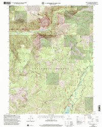
2000 Map of Royal Gorge
USGS Topo · Published 2003About this map
North Fork American River carves a deep path through this Placer County landscape, defining the boundaries of the Royal Gorge Wild Area within the Tahoe National Forest. The map documents a transition in land use, from the industrial legacy of the Walker Mine, Lost Emigrant Mine, and Placer Queen Mine to the modern utility of the French Meadows Reservoir and its associated Diversion Dam. High-elevation landmarks such as Snow Mountain and Sunflower Hill overlook a network of backcountry routes, including the Western States Trail and Truckee Foresthill Road. The presence of several group campsites like Black Bear (Group) and the Handy Camp (Site) reflects the area's development as a managed recreational resource at the turn of the millennium.
Find a feature on this map
50 named features on this map. Tap any name to fly to it.
Don’t see what you’re looking for? This feature index may not catch every label — zoom into the map to look around manually.
Map Details
Editions of this 2000 Royal Gorge Map
This is the sole edition of this map. No revisions or reprints were ever made.
Other maps of this area

1891 · Colfax
USGS Topo · 1:125,000

1891 · Truckee
USGS Topo · 1:125,000

1892 · Colfax
USGS Topo · 1:125,000

1893 · Truckee
USGS Topo · 1:125,000

1894 · Colfax
USGS Topo · 1:125,000

1895 · Truckee
USGS Topo · 1:125,000

1898 · Colfax
USGS Topo · 1:125,000

1900 · Colfax
USGS Topo · 1:125,000

1902 · Colfax
USGS Topo · 1:125,000

1932 · Truckee
USGS Topo · 1:96,000