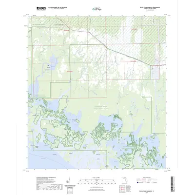
2024 Map of Royal Palm Hammock
USGS Topo · Published 2024About this map
The Ten Thousand Islands National Wildlife Refuge dominates this coastal landscape, where a dense labyrinth of mangrove islands and tidal waterways meets the Gulf of Mexico. At the transition from the upland Everglades to the sea, the settlement of Royal Palm Hammock sits near the junction of Tamiami Trl E and Co Rd 92, serving as a gateway to the preserve. Evidence of local navigation and land use appears in features like the Collier Seminole State Park Trl and the Blackwater River/Royal Palm Hammock Paddling Trl. Farther south, the map documents a complex aqueous geography of named passes and bays, including Dismal Key Pass and Coon Gravy Gate, reflecting the long history of fishing and maritime movement through these subtropical keys.
Find a feature on this map
65 named features on this map. Tap any name to fly to it.
Don’t see what you’re looking for? This feature index may not catch every label — zoom into the map to look around manually.
Map Details
Editions of this 2024 Royal Palm Hammock Map
This is the sole edition of this map. No revisions or reprints were ever made.
Other maps of this area

1956 · Miami
USGS Topo · 1:250,000

1956 · West Palm Beach
USGS Topo · 1:250,000

1957 · West Palm Beach
USGS Topo · 1:250,000

1958 · West Palm Beach
USGS Topo · 1:250,000

1958 · Miami
USGS Topo · 1:250,000

1958 · Belle Meade
USGS Topo · 1:24,000

1958 · Belle Meade SE
USGS Topo · 1:24,000

1959 · Deep Lake SW
USGS Topo · 1:24,000

1972 · Weavers Station
USGS Topo · 1:24,000

1973 · Cape Romano
USGS Topo · 1:24,000