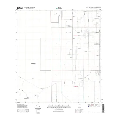
2015 Map of Royal Palm Ranger Station
USGS Topo · Published 2015About this map
The Everglades National Park boundary defines the transition between the expanding residential grid of south Florida and the preserved wetlands of the River of Grass. This 2015 survey shows the southwestern edge of Homestead and Florida City, where suburban streets like SW 344th St and SW 312th St abruptly terminate at the park's protected marshes. Within the park, the landscape is defined by the Taylor Slough drainage system and elevated hammocks such as Paradise Key and Pine Island. The Royal Palm Ranger Station serves as a primary access point to this unique environment. Significant hydrological management is visible through the Aerojet Canal Number C-111 and Canal 111E, which cut through the terrain to regulate water flow between the agricultural lands and the sensitive ecosystems of Parachute Key.
Find a feature on this map
77 named features on this map. Tap any name to fly to it.
Don’t see what you’re looking for? This feature index may not catch every label — zoom into the map to look around manually.
Map Details
Editions of this 2015 Royal Palm Ranger Station Map
This is the sole edition of this map. No revisions or reprints were ever made.
Other maps of this area

1949 · Goulds
USGS Topo · 1:24,000

1950 · Homestead
USGS Topo · 1:24,000

1950 · Glades
USGS Topo · 1:24,000

1956 · Goulds
USGS Topo · 1:24,000

1956 · Grossman Hammock
USGS Topo · 1:24,000

1956 · Homestead
USGS Topo · 1:24,000

1956 · Royal Palm Ranger Station
USGS Topo · 1:24,000

1956 · Glades
USGS Topo · 1:24,000

1956 · Royal Palm Ranger Station SE
USGS Topo · 1:24,000

1956 · Miami
USGS Topo · 1:250,000