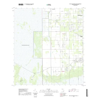
2018 Map of Royal Palm Ranger Station
USGS Topo · Published 2018About this map
Everglades National Park dominates the western half of this landscape, where the vast wetlands of the Everglades meet the advancing grid of Miami-Dade County. The transition from sawgrass to suburb is starkly defined by the Aerojet Canal Number C-111 and Canal 111E, which separate the conservation lands from the agricultural and residential outskirts of Homestead and Florida City. Within the park's boundaries, the topography is punctuated by raised hammocks such as Pine Island, Parachute Key, and Paradise Key, the latter hosting the Royal Palm Ranger Station. This 2018 survey captures the intricate water management system of Taylor Slough alongside the local infrastructure of the Miami Homestead General Aviation airport, illustrating the modern balance between environmental preservation and the needs of a growing southern Florida population.
Find a feature on this map
59 named features on this map. Tap any name to fly to it.
Don’t see what you’re looking for? This feature index may not catch every label — zoom into the map to look around manually.
Map Details
Editions of this 2018 Royal Palm Ranger Station Map
This is the sole edition of this map. No revisions or reprints were ever made.
Other maps of this area

1949 · Goulds
USGS Topo · 1:24,000

1950 · Homestead
USGS Topo · 1:24,000

1950 · Glades
USGS Topo · 1:24,000

1956 · Goulds
USGS Topo · 1:24,000

1956 · Grossman Hammock
USGS Topo · 1:24,000

1956 · Homestead
USGS Topo · 1:24,000

1956 · Royal Palm Ranger Station
USGS Topo · 1:24,000

1956 · Glades
USGS Topo · 1:24,000

1956 · Royal Palm Ranger Station SE
USGS Topo · 1:24,000

1956 · Miami
USGS Topo · 1:250,000