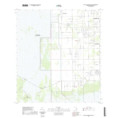
2021 Map of Royal Palm Ranger Station
USGS Topo · Published 2021About this map
Everglades National Park dominates the western half of this landscape, where the vast wetlands of The Everglades transition into the organized grids of Miami-Dade County. The interface between the natural hydrology of Taylor Slough and the industrial engineering of the Aerojet Canal Number C-111 and Canal L-31 E illustrates the complex water management systems of southern Florida.
Find a feature on this map
61 named features on this map. Tap any name to fly to it.
Don’t see what you’re looking for? This feature index may not catch every label — zoom into the map to look around manually.
Map Details
Editions of this 2021 Royal Palm Ranger Station Map
This is the sole edition of this map. No revisions or reprints were ever made.
Other maps of this area

1949 · Goulds
USGS Topo · 1:24,000

1950 · Homestead
USGS Topo · 1:24,000

1950 · Glades
USGS Topo · 1:24,000

1956 · Goulds
USGS Topo · 1:24,000

1956 · Grossman Hammock
USGS Topo · 1:24,000

1956 · Homestead
USGS Topo · 1:24,000

1956 · Royal Palm Ranger Station
USGS Topo · 1:24,000

1956 · Glades
USGS Topo · 1:24,000

1956 · Royal Palm Ranger Station SE
USGS Topo · 1:24,000

1956 · Miami
USGS Topo · 1:250,000